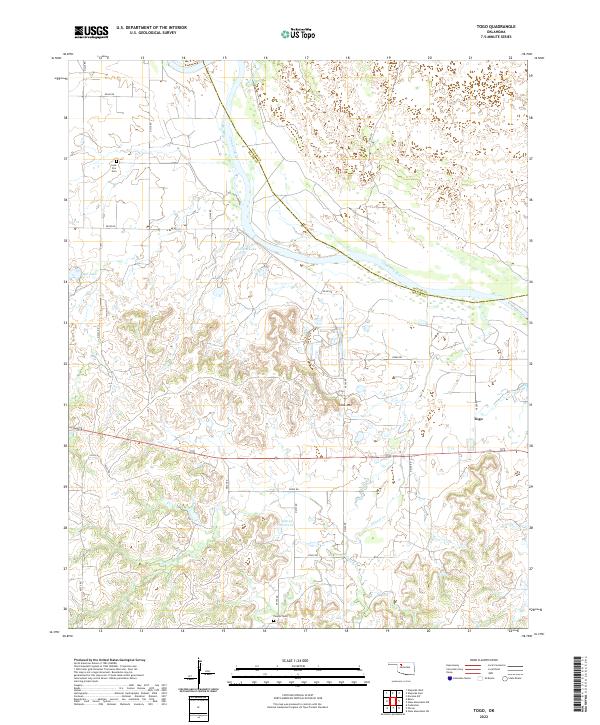
2022 Map of Togo
USGS Topo · Published 2022About this map
The Cimarron River carves a broad valley through the northern half of this landscape, marking the boundary where Woods and Major counties meet. The terrain transitions from the river's alluvial flats to the more varied topography of the south, where Lone Mtn rises above the surrounding drainage networks of Griever Cr. Settlement in this rural portion of Major County is sparse, centered primarily around the small community of Togo along the eastern edge. Local family history and genealogy are anchored by established burial sites, including Lone Star Cem in the northwest and Connor Cem near the southern boundary. The presence of several small water bodies, such as Bell Lake, Callison Lake, and the 093005 Reservoir, indicates the importance of managed water resources for the local agricultural and ranching economy.
Find a feature on this map
31 named features on this map. Tap any name to fly to it.
Don’t see what you’re looking for? This feature index may not catch every label — zoom into the map to look around manually.
Map Details
Editions of this 2022 Togo Map
This is the sole edition of this map. No revisions or reprints were ever made.
Other maps of this area

1955 · Woodward
USGS Topo · 1:250,000

1958 · Woodward
USGS Topo · 1:250,000

1969 · Phroso
USGS Topo · 1:24,000

1969 · Belva
USGS Topo · 1:24,000

1969 · Dacoma SW
USGS Topo · 1:24,000

1969 · Glass Mountains NW
USGS Topo · 1:24,000

1969 · Waynoka East
USGS Topo · 1:24,000

1969 · Cedardale
USGS Topo · 1:24,000

1969 · Togo
USGS Topo · 1:24,000

1969 · Waynoka West
USGS Topo · 1:24,000