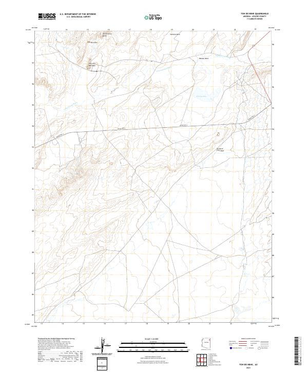
2021 Map of Toh De Niihe
USGS Topo · Published 2021About this map
White Horse Butte and the surrounding high desert terrain dominate this part of the Navajo Nation in northeastern Arizona. The landscape is defined by the carved drainage systems of Cottonwood Wash and Balakai Wash, which illustrate the complex hydrography of the high plateau. Indigenous place names are preserved across the topography, including prominent landforms like Tse Lichii Dah Azka and the Ventana Mesa to the north.
Find a feature on this map
14 named features on this map. Tap any name to fly to it.
Don’t see what you’re looking for? This feature index may not catch every label — zoom into the map to look around manually.
Map Details
Editions of this 2021 Toh De Niihe Map
This is the sole edition of this map. No revisions or reprints were ever made.
Other maps of this area

1886 · Fort Defiance
USGS Topo · 1:250,000

1892 · Fort Defiance
USGS Topo · 1:250,000

1892 · Canyon De Chelly
USGS Topo · 1:250,000

1954 · Shiprock
USGS Topo · 1:250,000

1954 · Gallup
USGS Topo · 1:250,000

1955 · Chinle 4 NE
USGS Topo · 1:24,000

1955 · Chinle 4 SE
USGS Topo · 1:24,000
1955 · Ganado 1 NE
USGS Topo · 1:24,000

1958 · Gallup
USGS Topo · 1:250,000

1958 · Shiprock
USGS Topo · 1:250,000