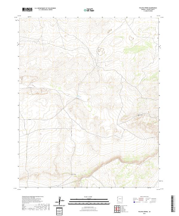
2021 Map of Tolapai Spring
USGS Topo · Published 2021About this map
Tolapai Spring serves as a vital water source in this high-desert reach of Apache County, where the landscape is defined by the ephemeral drainage of Parker Draw. The topography is marked by steady elevation gains toward the east, culminating at the distinctive prominence of Rattlesnake Hill. This 2021 survey illustrates a sparse network of access routes, primarily dominated by the east-west corridor of Clay Mine Rd, which traverses the central townships. The geographic organization of the area is framed by the grid of the Public Land Survey System, specifically detailing the corners of Townships 20 and 21 North. This map records a largely undeveloped landscape, where natural landmarks and isolated water sources like the spring provide the primary points of orientation for navigation and land management.
Find a feature on this map
8 named features on this map. Tap any name to fly to it.
Don’t see what you’re looking for? This feature index may not catch every label — zoom into the map to look around manually.
Map Details
Editions of this 2021 Tolapai Spring Map
This is the sole edition of this map. No revisions or reprints were ever made.
Other maps of this area

1886 · Fort Defiance
USGS Topo · 1:250,000

1892 · Fort Defiance
USGS Topo · 1:250,000

1954 · Gallup
USGS Topo · 1:250,000

1958 · Gallup
USGS Topo · 1:250,000

1959 · Gallup
USGS Topo · 1:250,000

1962 · Gallup
USGS Topo · 1:250,000

1967 · Gallup
USGS Topo · 1:250,000

1971 · Burntwater Wash
USGS Topo · 1:24,000
1971 · Chafin Well
USGS Topo · 1:24,000
1971 · High Lonesome Well
USGS Topo · 1:24,000