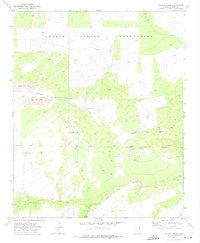
1971 Map of Tolapai Spring
USGS Topo · Published 1975About this map
The Navajo Indian Reservation landscape within the Apache County desert is defined here by sparse water resources and nascent industrial extraction. Water management is the primary marker of human presence, with a network of isolated sources including Tolapai Spring, Bluebird Well, and Middle Well supporting the arid terrain. These points of interest, along with Little Well and a dedicated Water Tank, underscore the critical nature of water rights in this high-desert environment.
Find a feature on this map
16 named features on this map. Tap any name to fly to it.
Don’t see what you’re looking for? This feature index may not catch every label — zoom into the map to look around manually.
Map Details
Editions of this 1971 Tolapai Spring Map
This is the sole edition of this map. No revisions or reprints were ever made.
Other maps of this area

1886 · Fort Defiance
USGS Topo · 1:250,000

1892 · Fort Defiance
USGS Topo · 1:250,000

1954 · Gallup
USGS Topo · 1:250,000

1958 · Gallup
USGS Topo · 1:250,000

1959 · Gallup
USGS Topo · 1:250,000

1962 · Gallup
USGS Topo · 1:250,000

1967 · Gallup
USGS Topo · 1:250,000

1971 · Burntwater Wash
USGS Topo · 1:24,000
1971 · Chafin Well
USGS Topo · 1:24,000
1971 · High Lonesome Well
USGS Topo · 1:24,000