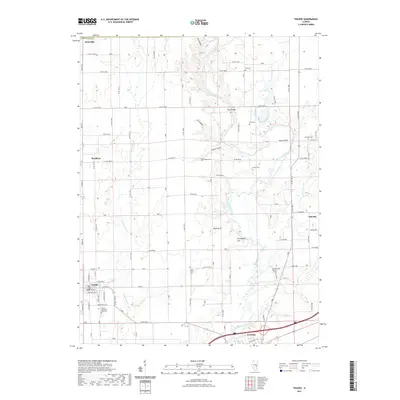
2021 Map of Toledo
USGS Topo · Published 2021About this map
Toledo and Greenup anchor this central Illinois landscape, where the meandering course of the Embarras River carves a distinctive valley through the prairie. The map documents a rural network of small settlements including Janesville, Bradbury, and Timothy, connected by an extensive grid of county roads. Local history and genealogy are well-represented by numerous family-named landmarks and resting places, such as Tippett Cem, Hutton Cem, and the appropriately named Graveyard Hill. Terrain features like Sconce Bend and several named hollows—including Gold Hollow and Lick Hollow—reveal how the river and its tributaries, such as Cottonwood Cr and Hurricane Cr, have shaped the region's topography. The proximity of Friends Grove Cem and Harmony Cem to the river's edge suggests the early importance of the valley for community life and settlement.
Find a feature on this map
69 named features on this map. Tap any name to fly to it.
Don’t see what you’re looking for? This feature index may not catch every label — zoom into the map to look around manually.
Map Details
Editions of this 2021 Toledo Map
This is the sole edition of this map. No revisions or reprints were ever made.
Other maps of this area

1933 · Toledo
USGS Topo · 1:62,500

1934 · Mattoon
USGS Topo · 1:62,500

1937 · Mattoon
USGS Topo · 1:62,500

1938 · Toledo
USGS Topo · 1:62,500

1940 · Greenup
USGS Topo · 1:62,500

1943 · Greenup
USGS Topo · 1:62,500

1953 · Teutopolis
USGS Topo · 1:62,500

1958 · Decatur
USGS Topo · 1:250,000

1961 · Decatur
USGS Topo · 1:250,000
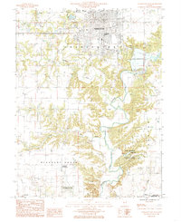
1984 · Charleston South
USGS Topo · 1:24,000