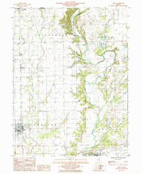
1984 Map of Toledo
USGS Topo · Published 1985About this map
The Embarras River carves a winding path through the center of this landscape, flanked by prominent elevations like Graveyard Hill and Buck Knoll. Near the western edge, the county seat of Toledo sits alongside an Abandoned RR, signaling the shift in transportation that occurred as regional rail lines gave way to the developing highway network. The river's influence is clear in the local naming, from the sharp turn at Sconoe Bend to the drainage of Cottonwood Creek and Hurricane Creek. Smaller rural hubs like Bradbury, Timothy, and Janesville are distributed across the township boundaries of Cottonwood and Sumper. This survey captures the rural character of Cumberland County before the late 20th-century expansion of modern infrastructure, preserving the locations of numerous local Cem sites and industrial markers such as a Pumping Station and several Gravel Pit operations.
Find a feature on this map
36 named features on this map. Tap any name to fly to it.
Don’t see what you’re looking for? This feature index may not catch every label — zoom into the map to look around manually.
Map Details
Editions of this 1984 Toledo Map
This is the sole edition of this map. No revisions or reprints were ever made.
Other maps of this area

1933 · Toledo
USGS Topo · 1:62,500

1934 · Mattoon
USGS Topo · 1:62,500

1937 · Mattoon
USGS Topo · 1:62,500

1938 · Toledo
USGS Topo · 1:62,500

1940 · Greenup
USGS Topo · 1:62,500

1943 · Greenup
USGS Topo · 1:62,500

1953 · Teutopolis
USGS Topo · 1:62,500

1958 · Decatur
USGS Topo · 1:250,000

1961 · Decatur
USGS Topo · 1:250,000
1984 · Charleston South
USGS Topo · 1:24,000