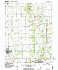
1998 Map of Toledo
USGS Topo · Published 2002About this map
Toledo and Greenup anchor this late-twentieth-century study of the southern Illinois landscape, where the Embarras River carves a winding path through the townships of Sumter and Greenup. The terrain transitions from the high, flat agricultural fields of Cottonwood township to the more complex topography surrounding Sconce Bend and Hurricane Creek. Natural landmarks like Buck Knoll and Graveyard Hill rise above the river valley, while smaller drainages such as Lick Hollow and Tippett Hollow drain the surrounding timber and farmland.
Find a feature on this map
36 named features on this map. Tap any name to fly to it.
Don’t see what you’re looking for? This feature index may not catch every label — zoom into the map to look around manually.
Map Details
Editions of this 1998 Toledo Map
This is the sole edition of this map. No revisions or reprints were ever made.
Other maps of this area

1933 · Toledo
USGS Topo · 1:62,500

1934 · Mattoon
USGS Topo · 1:62,500

1937 · Mattoon
USGS Topo · 1:62,500

1938 · Toledo
USGS Topo · 1:62,500

1940 · Greenup
USGS Topo · 1:62,500

1943 · Greenup
USGS Topo · 1:62,500

1953 · Teutopolis
USGS Topo · 1:62,500

1958 · Decatur
USGS Topo · 1:250,000

1961 · Decatur
USGS Topo · 1:250,000
1984 · Charleston South
USGS Topo · 1:24,000