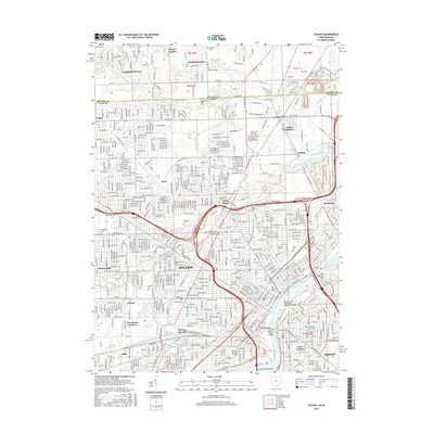
2016 Map of Toledo
USGS Topo · Published 2016About this map
The Maumee River serves as the central artery for this industrial landscape, where the urban core of Toledo meets the state line of Michigan. The river is spanned by several significant structures, including the Anthony Wayne Bridge and the Craig Memorial Bridge, reflecting a city defined by its waterways. The landscape transitions from the dense street grids of West Toledo and East Toledo to the more open residential patterns of Ottawa Hills and Trilby.
Find a feature on this map
69 named features on this map. Tap any name to fly to it.
Don’t see what you’re looking for? This feature index may not catch every label — zoom into the map to look around manually.
Map Details
Editions of this 2016 Toledo Map
This is the sole edition of this map. No revisions or reprints were ever made.
Other maps of this area

1900 · Maumee Bay
USGS Topo · 1:62,500

1900 · Toledo
USGS Topo · 1:62,500

1912 · Monroe
USGS Topo · 1:62,500

1912 · Dundee
USGS Topo · 1:62,500

1914 · Monroe
USGS Topo · 1:62,500

1926 · Dundee
USGS Topo · 1:62,500

1934 · Point Place
USGS Topo · 1:24,000

1934 · Rossford
USGS Topo · 1:24,000

1935 · Walbridge
USGS Topo · 1:24,000

1935 · Maumee
USGS Topo · 1:24,000