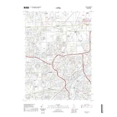
2019 Map of Toledo
USGS Topo · Published 2019About this map
The Maumee River serves as the dominant geographical feature of this 2019 survey, cutting through the heart of Toledo and supporting a network of massive transit infrastructure including the Craig Memorial Bridge and the Anthony Wayne Bridge. The map details a densely developed urban and suburban landscape, from the campus of the University of Toledo to the sprawling rail yards at Air-Line Junction. Genealogical interests are well-served by the inclusion of numerous burial grounds such as Forest Cem, Calvary Cem, and Mount Carmel Cem. The northern border of the map captures the Michigan-Ohio state line, illustrating the historical boundary between Monroe and Lucas counties. Neighborhoods like Ottawa Hills, East Toledo, and Trilby are mapped alongside central landmarks like the Lucas County Courthouse and the Mercy College of Ohio.
Find a feature on this map
60 named features on this map. Tap any name to fly to it.
Don’t see what you’re looking for? This feature index may not catch every label — zoom into the map to look around manually.
Map Details
Editions of this 2019 Toledo Map
This is the sole edition of this map. No revisions or reprints were ever made.
Other maps of this area

1900 · Maumee Bay
USGS Topo · 1:62,500

1900 · Toledo
USGS Topo · 1:62,500

1912 · Monroe
USGS Topo · 1:62,500

1912 · Dundee
USGS Topo · 1:62,500

1914 · Monroe
USGS Topo · 1:62,500

1926 · Dundee
USGS Topo · 1:62,500

1934 · Point Place
USGS Topo · 1:24,000

1934 · Rossford
USGS Topo · 1:24,000

1935 · Walbridge
USGS Topo · 1:24,000

1935 · Maumee
USGS Topo · 1:24,000