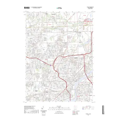
2023 Map of Toledo
USGS Topo · Published 2023About this map
The Maumee River serves as the focal point for this urban landscape, dividing the core of Toledo from East Toledo and Oregon. The city's mid-20th-century development is evident in the dense street grids and the concentrations of industrial and transportation hubs, such as the Air Line Junction and the complex rail networks of CSX, Norfolk Southern, and Conrail. These corridors highlight the region's historical role as a primary Midwestern logistics center.
Find a feature on this map
60 named features on this map. Tap any name to fly to it.
Don’t see what you’re looking for? This feature index may not catch every label — zoom into the map to look around manually.
Map Details
Editions of this 2023 Toledo Map
This is the sole edition of this map. No revisions or reprints were ever made.
Other maps of this area

1900 · Maumee Bay
USGS Topo · 1:62,500

1900 · Toledo
USGS Topo · 1:62,500

1912 · Monroe
USGS Topo · 1:62,500

1912 · Dundee
USGS Topo · 1:62,500

1914 · Monroe
USGS Topo · 1:62,500

1926 · Dundee
USGS Topo · 1:62,500

1934 · Point Place
USGS Topo · 1:24,000

1934 · Rossford
USGS Topo · 1:24,000

1935 · Walbridge
USGS Topo · 1:24,000

1935 · Maumee
USGS Topo · 1:24,000