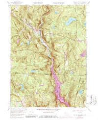
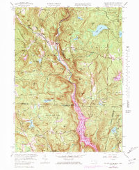
1958 Map of Tolland Center
USGS Topo · Published 1986About this map
Tolland Center and the upper reaches of the Farmington River West Branch define this borderland landscape between Massachusetts and Connecticut. The 1969 photorevisions highlight the significant impact of the Colebrook River Reservoir, which transformed the southern river valley as it stretches toward North Colebrook. Higher elevations are marked by a series of named peaks like Hanging Mtn and Mount Prospect, punctuated by numerous upland water bodies including Noyes Pond, Lake Marguerite, and Mirror Lake.
Find a feature on this map
76 named features on this map. Tap any name to fly to it.
Don’t see what you’re looking for? This feature index may not catch every label — zoom into the map to look around manually.
Map Details
Editions of this 1958 Tolland Center Map
5 editions found
Other maps of this area

1887 · Granville
USGS Topo · 1:62,500

1888 · Sandisfield
USGS Topo · 1:62,500

1889 · Granville
USGS Topo · 1:62,500

1892 · Winsted
USGS Topo · 1:62,500

1892 · Granby
USGS Topo · 1:62,500

1893 · Granville
USGS Topo · 1:62,500

1893 · Sandisfield
USGS Topo · 1:62,500

1895 · Granville
USGS Topo · 1:62,500

1896 · Holyoke
USGS Topo · 1:125,000

1897 · Sandisfield
USGS Topo · 1:62,500