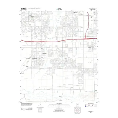
2011 Map of Tolleson
USGS Topo · Published 2011About this map
Litchfield Park and the surrounding west valley communities are presented during a period of significant suburban expansion in this 2011 survey. The map details the complex residential networks of Avondale, Goodyear, and Tolleson, revealing how master-planned neighborhoods like Villa de Paz and Winnwood Homes have filled the landscape between the historical agricultural corridors. A critical geographic landmark, the Initial Point, is located near Monument Hill at the confluence where the Gila River meets the Salt River, marking the foundational reference for Arizona's land surveys.
Find a feature on this map
68 named features on this map. Tap any name to fly to it.
Don’t see what you’re looking for? This feature index may not catch every label — zoom into the map to look around manually.
Map Details
Editions of this 2011 Tolleson Map
This is the sole edition of this map. No revisions or reprints were ever made.
Other maps of this area

1912 · Phoenix
USGS Topo · 1:62,500

1914 · Phoenix
USGS Topo · 1:62,500

1946 · Avondale
USGS Topo · 1:62,500

1948 · Cashion
USGS Topo · 1:62,500

1952 · Laveen
USGS Topo · 1:24,000

1952 · Fowler
USGS Topo · 1:24,000

1952 · Phoenix
USGS Topo · 1:62,500

1954 · Phoenix
USGS Topo · 1:250,000

1957 · Phoenix
USGS Topo · 1:250,000

1957 · Perryville
USGS Topo · 1:24,000