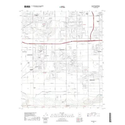
2018 Map of Tolleson
USGS Topo · Published 2018About this map
The Agua Fria River courses southward through the center of this Maricopa County landscape, separating the established residential blocks of Avondale from the growing neighborhoods of Goodyear. Near the center of the survey, the Goodyear Farms Historic Cem and Estrella Mtn Community College stand as prominent landmarks amidst the shifting urban-agricultural boundary. To the south, the confluence region near the Gila River and Salt River marks a significant geographic transition at Monument Hill Initial Point, the surveying origin for much of Arizona.
Find a feature on this map
119 named features on this map. Tap any name to fly to it.
Don’t see what you’re looking for? This feature index may not catch every label — zoom into the map to look around manually.
Map Details
Editions of this 2018 Tolleson Map
This is the sole edition of this map. No revisions or reprints were ever made.
Other maps of this area

1912 · Phoenix
USGS Topo · 1:62,500

1914 · Phoenix
USGS Topo · 1:62,500

1946 · Avondale
USGS Topo · 1:62,500

1948 · Cashion
USGS Topo · 1:62,500

1952 · Laveen
USGS Topo · 1:24,000

1952 · Fowler
USGS Topo · 1:24,000

1952 · Phoenix
USGS Topo · 1:62,500

1954 · Phoenix
USGS Topo · 1:250,000

1957 · Phoenix
USGS Topo · 1:250,000

1957 · Perryville
USGS Topo · 1:24,000