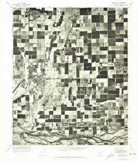
1971 Map of Tolleson
USGS Topo · Published 1972About this map
The agricultural landscape of the Salt River Valley is captured in high detail through this 1971 orthophotomosaic, showing a mosaic of irrigated fields surrounding the growing desert communities. Tolleson and Avondale are clearly defined as concentrated clusters of development amid a vast grid of farmland, while the planned community of Litchfield Park sits at the northern edge. The south is anchored by the braided channels of the Gila River, which flows through an uncultivated corridor. This specific format—an orthophotoquad—provides a photographic perspective on land use, revealing the precise density of residential tracts in Cashion and the industrial or utility structures that supported the area's mid-century expansion.
Find a feature on this map
5 named features on this map. Tap any name to fly to it.
Don’t see what you’re looking for? This feature index may not catch every label — zoom into the map to look around manually.
Map Details
Editions of this 1971 Tolleson Map
This is the sole edition of this map. No revisions or reprints were ever made.
Other maps of this area

1912 · Phoenix
USGS Topo · 1:62,500

1914 · Phoenix
USGS Topo · 1:62,500

1946 · Avondale
USGS Topo · 1:62,500

1948 · Cashion
USGS Topo · 1:62,500

1952 · Laveen
USGS Topo · 1:24,000

1952 · Fowler
USGS Topo · 1:24,000

1952 · Phoenix
USGS Topo · 1:62,500

1954 · Phoenix
USGS Topo · 1:250,000

1957 · Phoenix
USGS Topo · 1:250,000

1957 · Perryville
USGS Topo · 1:24,000