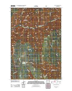
2011 Map of Tollgate
USGS Topo · Published 2011About this map
Tollgate serves as a central hub in this high-elevation landscape, where the waters of Langdon Lake and the recreational grounds of the Spout Springs Ski Area meet. The area is defined by its deep canyons and prominent ridges, with the South Fork Walla Walla River carving through the northern sector while Lookingglass Creek and Woodward Creek drain the southern slopes. This 2011 survey captures the infrastructure of the Umatilla National Forest, including fire management sites like Mcintyre Lookout and the Spout Springs Lookout Tower.
Find a feature on this map
42 named features on this map. Tap any name to fly to it.
Don’t see what you’re looking for? This feature index may not catch every label — zoom into the map to look around manually.
Map Details
Editions of this 2011 Tollgate Map
This is the sole edition of this map. No revisions or reprints were ever made.
Other maps of this area

1953 · Pendleton
USGS Topo · 1:250,000

1955 · Grangeville
USGS Topo · 1:250,000

1956 · Pendleton
USGS Topo · 1:250,000

1959 · Grangeville
USGS Topo · 1:250,000

1963 · Big Meadows
USGS Topo · 1:24,000

1963 · Andies Prairie
USGS Topo · 1:24,000

1963 · Bingham Springs
USGS Topo · 1:24,000

1963 · Tollgate
USGS Topo · 1:24,000

1963 · Blalock Mountain
USGS Topo · 1:24,000

1963 · Peterson Ridge
USGS Topo · 1:24,000