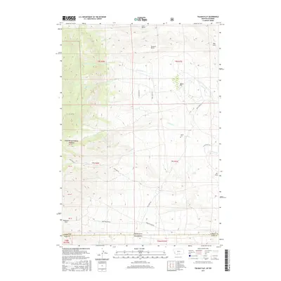
2017 Map of Tolman Flat
USGS Topo · Published 2017About this map
Tolman Cem sits as a quiet landmark on the high plains near the Montana-Wyoming border, where the land transitions from the high elevations of the Custer National Forest down toward the drainage basins of the Clark Fork. This high-altitude landscape is defined by its dramatic topography of flat-topped mesas and deep incisions, notably Tolman Flat, Dilworth Bench, and Ruler Bench. The drainage pattern is complex, with Wolf Cr and Ruby Cr cutting through the terrain, fed by isolated water sources like Three Corner Spring and Corner Spring. The map reveals a network of remote access routes, including Ruby Creek Rd and Robertson Draw Rd, which navigate the steep descents of Mill Draw and Robertson Draw, tracing the natural paths through the breaks in the benchland.
Find a feature on this map
32 named features on this map. Tap any name to fly to it.
Don’t see what you’re looking for? This feature index may not catch every label — zoom into the map to look around manually.
Map Details
Editions of this 2017 Tolman Flat Map
This is the sole edition of this map. No revisions or reprints were ever made.
Other maps of this area

1944 · Red Lodge
USGS Topo · 1:62,500

1950 · Clark
USGS Topo · 1:62,500

1950 · Deep Lake
USGS Topo · 1:62,500

1954 · Billings
USGS Topo · 1:250,000

1955 · Cody
USGS Topo · 1:250,000

1956 · Mount Maurice
USGS Topo · 1:62,500

1957 · Billings
USGS Topo · 1:250,000

1958 · Billings
USGS Topo · 1:250,000

1958 · Cody
USGS Topo · 1:250,000

1962 · Cody
USGS Topo · 1:250,000