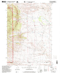
1996 Map of Tolman Flat
USGS Topo · Published 1999About this map
Tolman Flat sits at the high-elevation intersection of the northern Bighorn Basin and the Beartooth foothills, where the state line divides the landscape between Carbon County and its southern neighbors. The terrain is defined by dramatic drainage systems, notably Wolf Creek and the North Fork and South Fork tributaries, which carve through the rising elevation of the Custer National Forest. The historical Meeteese Trail cuts across this high benchland, tracing a route used by early travelers and freighters through the region. Industrial activity is represented by the Grove Creek Mine near Tiger Gulch, marking the intersection of resource extraction and the difficult topography of the Dilworth Bench. Numerous springs, including Corner Spring and Three Corner Spring, indicate the vital water sources required for livestock and transit in this arid mountain borderland.
Find a feature on this map
21 named features on this map. Tap any name to fly to it.
Don’t see what you’re looking for? This feature index may not catch every label — zoom into the map to look around manually.
Map Details
Editions of this 1996 Tolman Flat Map
This is the sole edition of this map. No revisions or reprints were ever made.
Other maps of this area

1944 · Red Lodge
USGS Topo · 1:62,500

1950 · Clark
USGS Topo · 1:62,500

1950 · Deep Lake
USGS Topo · 1:62,500

1954 · Billings
USGS Topo · 1:250,000

1955 · Cody
USGS Topo · 1:250,000

1956 · Mount Maurice
USGS Topo · 1:62,500

1957 · Billings
USGS Topo · 1:250,000

1958 · Billings
USGS Topo · 1:250,000

1958 · Cody
USGS Topo · 1:250,000

1962 · Cody
USGS Topo · 1:250,000