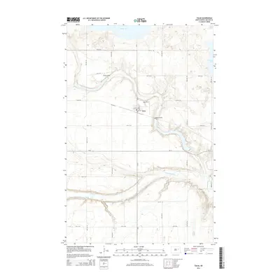
2014 Map of Tolna
USGS Topo · Published 2014About this map
Tolna stands at a transition between the elevated plains and the dramatic carved topography of the Tolna Coulee, which winds through the center of the landscape before joining the Sheyenne River in the south. The township is characterized by a high density of small depressions and seasonal wetlands typical of the North Dakota prairie, with the northern edge defined by the irregular shoreline of Stump Lake. Local history is anchored by the Saint Marys Cem located just north of the town center, while a rigid grid of county roads and avenues like Lee Ave and Welcome Ave provides structure to the rural agricultural tracts. This 2014 survey records the modern infrastructure of ND-15 and Co Road 24, demonstrating how transportation routes have adapted to the winding coulees and river valleys that define the Nelson County terrain.
Find a feature on this map
24 named features on this map. Tap any name to fly to it.
Don’t see what you’re looking for? This feature index may not catch every label — zoom into the map to look around manually.
Map Details
Editions of this 2014 Tolna Map
This is the sole edition of this map. No revisions or reprints were ever made.
Other maps of this area

1930 · Pekin
USGS Topo · 1:62,500

1930 · Hamar
USGS Topo · 1:62,500

1950 · Devils Lake Mountain
USGS Topo · 1:24,000

1951 · Pekin NE
USGS Topo · 1:24,000

1951 · Devils Lake Mountain
USGS Topo · 1:24,000

1951 · Pekin NW
USGS Topo · 1:24,000

1951 · Tolna
USGS Topo · 1:24,000

1951 · Pekin
USGS Topo · 1:24,000

1951 · Pekin
USGS Topo · 1:62,500

1952 · New Rockford
USGS Topo · 1:250,000