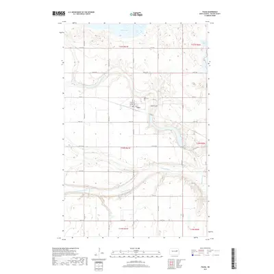
2017 Map of Tolna
USGS Topo · Published 2017About this map
Tolna serves as the primary settlement center in this portion of Nelson County, organized around a grid of streets including Main St, Lee Ave, and Welcome Ave. The town sits just south of the Tolna Coulee, a significant drainage feature that carves through the prairie landscape. To the north, the waters of Stump Lake reach into the quadrangle, while the Sheyenne River winds through the southern sections, creating a distinct topographical contrast between the flat upland agricultural blocks and the carved river valley.
Find a feature on this map
32 named features on this map. Tap any name to fly to it.
Don’t see what you’re looking for? This feature index may not catch every label — zoom into the map to look around manually.
Map Details
Editions of this 2017 Tolna Map
This is the sole edition of this map. No revisions or reprints were ever made.
Other maps of this area

1930 · Pekin
USGS Topo · 1:62,500

1930 · Hamar
USGS Topo · 1:62,500

1950 · Devils Lake Mountain
USGS Topo · 1:24,000

1951 · Pekin NE
USGS Topo · 1:24,000

1951 · Devils Lake Mountain
USGS Topo · 1:24,000

1951 · Pekin NW
USGS Topo · 1:24,000

1951 · Tolna
USGS Topo · 1:24,000

1951 · Pekin
USGS Topo · 1:24,000

1951 · Pekin
USGS Topo · 1:62,500

1952 · New Rockford
USGS Topo · 1:250,000