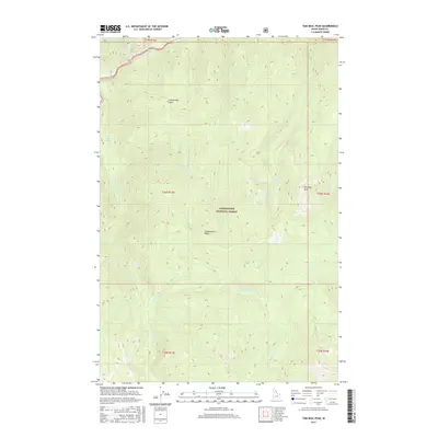
2017 Map of Tom Beal Peak
USGS Topo · Published 2017About this map
Jerry Johnson Hot Springs and the northern flow of the Lochsa River define the northwestern corner of this territory within the Clearwater National Forest. The landscape is dominated by high-altitude features and the complex drainage systems that feed into the Lochsa, including Warm Springs Cr and Wind Lakes Cr. Named elevations such as Tom Beal Peak and Hot Springs Point provide significant landmarks for understanding the local topography and watershed boundaries. Further south, Cooperation Point overlooks the intersections of Cooperation Cr and surrounding ridges. This survey illustrates the protected wilderness character of Idaho County in the modern era, focusing on the preservation of natural geothermal sites and the intricate network of mountain creeks like Robin Cr and Saturday Cr that shape this remote forest region.
Find a feature on this map
24 named features on this map. Tap any name to fly to it.
Don’t see what you’re looking for? This feature index may not catch every label — zoom into the map to look around manually.
Map Details
Editions of this 2017 Tom Beal Peak Map
This is the sole edition of this map. No revisions or reprints were ever made.
Other maps of this area

1911 · Lolo
USGS Topo · 1:250,000

1913 · Lolo
USGS Topo · 1:250,000

1956 · Hamilton
USGS Topo · 1:250,000

1959 · Hamilton
USGS Topo · 1:250,000

1960 · Hamilton
USGS Topo · 1:250,000

1964 · Hamilton
USGS Topo · 1:250,000

1964 · Rocky Point
USGS Topo · 1:24,000

1966 · Mc Connell Mtn
USGS Topo · 1:24,000

1966 · Grave Peak
USGS Topo · 1:24,000
1966 · Hungry Rock
USGS Topo · 1:24,000