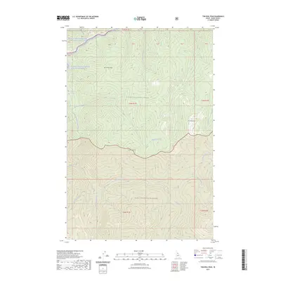
2023 Map of Tom Beal Peak
USGS Topo · Published 2023About this map
Tom Beal Peak dominates the eastern high ground of this interior Idaho landscape, where the Clearwater National Forest meets the protected reaches of the Selway-Bitterroot Wilderness. The northern edge of the survey is defined by the corridor of the Lochsa River, a segment of the Middle Fork Clearwater Wild and Scenic River that serves as the primary drainage for a dense network of tributaries. These waterways, including Eagle Creek and Robin Creek, carve deep drainages through the steep terrain between landmarks like Hot Springs Point and Cooperation Point. The map provides a detailed view of these remote mountain headwaters, tracing the paths of Wind Lakes Creek and Saturday Creek through some of the most undeveloped territory in the region. This 2023 edition documents the area's contemporary boundaries and natural features for recreation and land management.
Find a feature on this map
32 named features on this map. Tap any name to fly to it.
Don’t see what you’re looking for? This feature index may not catch every label — zoom into the map to look around manually.
Map Details
Editions of this 2023 Tom Beal Peak Map
This is the sole edition of this map. No revisions or reprints were ever made.
Other maps of this area

1911 · Lolo
USGS Topo · 1:250,000

1913 · Lolo
USGS Topo · 1:250,000

1956 · Hamilton
USGS Topo · 1:250,000

1959 · Hamilton
USGS Topo · 1:250,000

1960 · Hamilton
USGS Topo · 1:250,000

1964 · Hamilton
USGS Topo · 1:250,000

1964 · Rocky Point
USGS Topo · 1:24,000

1966 · Mc Connell Mtn
USGS Topo · 1:24,000

1966 · Grave Peak
USGS Topo · 1:24,000
1966 · Hungry Rock
USGS Topo · 1:24,000