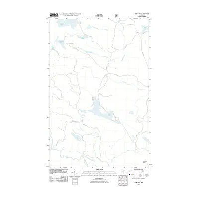
2011 Map of Tom Lake
USGS Topo · Published 2011About this map
Judge Magney State Park anchors the southern reaches of this landscape, where the Brule River and Flute Reed River wind through the North Shore hinterlands. The area is defined by an intricate network of waterways and timber access routes, including Tom Lake Rd and County Hwy 16, which connect the numerous glacial lakes. Higher elevations are marked by Farquhar Knob and the Devilfish Lookout Tower, providing vantage points over Devilfish Lake and Chester Lake. This 2011 survey captures the region's character as a managed wilderness, where the Swamp River and Mons Creek drain a complex system of bogs and basins. Traces of local geography such as Portage Falls and Lost Lake reflect a terrain largely shaped by its hydrology and the forestry roads that pierce the interior.
Find a feature on this map
40 named features on this map. Tap any name to fly to it.
Don’t see what you’re looking for? This feature index may not catch every label — zoom into the map to look around manually.
Map Details
Editions of this 2011 Tom Lake Map
This is the sole edition of this map. No revisions or reprints were ever made.
Other maps of this area

1954 · Two Harbors
USGS Topo · 1:250,000

1957 · Two Harbors
USGS Topo · 1:250,000

1957 · Quetico
USGS Topo · 1:250,000

1958 · Two Harbors
USGS Topo · 1:250,000

1958 · Hancock
USGS Topo · 1:250,000

1959 · Northern Light Lake
USGS Topo · 1:24,000

1959 · Pine Lake East
USGS Topo · 1:24,000

1959 · Tom Lake
USGS Topo · 1:24,000

1959 · Pine Lake West
USGS Topo · 1:24,000

1959 · Fort William
USGS Topo · 1:250,000