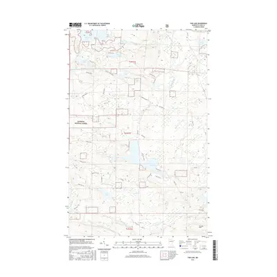
2016 Map of Tom Lake
USGS Topo · Published 2016About this map
Tom Lake and the surrounding wilderness of the Superior National Forest define this landscape in the eastern corner of Cook County. The terrain is characterized by a high density of water bodies, including Devilfish Lake, Esther Lake, and Chester Lake, which drain through a network of small waterways like Portage Brook and Beaverdam Cr. The mapping shows a rugged, high-elevation environment marked by S Esther Summit and Farquhar Knob, with water cascading at Portage Falls.
Find a feature on this map
45 named features on this map. Tap any name to fly to it.
Don’t see what you’re looking for? This feature index may not catch every label — zoom into the map to look around manually.
Map Details
Editions of this 2016 Tom Lake Map
This is the sole edition of this map. No revisions or reprints were ever made.
Other maps of this area

1954 · Two Harbors
USGS Topo · 1:250,000

1957 · Two Harbors
USGS Topo · 1:250,000

1957 · Quetico
USGS Topo · 1:250,000

1958 · Two Harbors
USGS Topo · 1:250,000

1958 · Hancock
USGS Topo · 1:250,000

1959 · Northern Light Lake
USGS Topo · 1:24,000

1959 · Pine Lake East
USGS Topo · 1:24,000

1959 · Tom Lake
USGS Topo · 1:24,000

1959 · Pine Lake West
USGS Topo · 1:24,000

1959 · Fort William
USGS Topo · 1:250,000