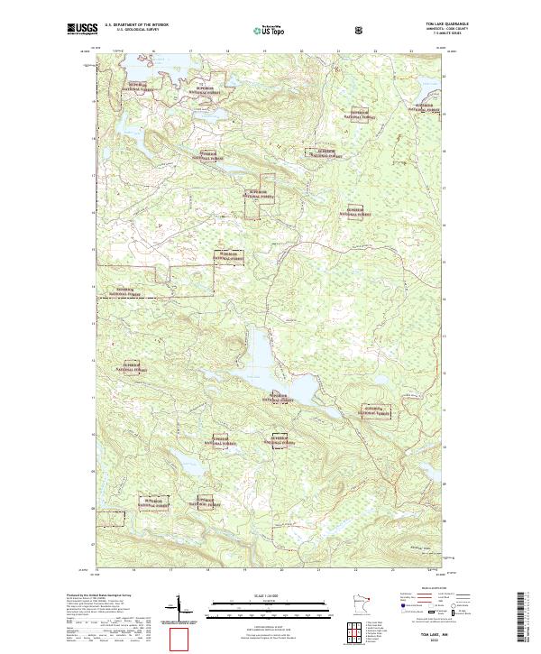
2022 Map of Tom Lake
USGS Topo · Published 2022About this map
Superior National Forest encompasses this stretch of Cook County, where the landscape is defined by the headwaters of the Brule River and the Flute Reed River. The topography is characterized by prominent high points such as Esther Summit and Farquhar Knob, overlooking a network of glacial lakes including Tom Lake, Devilfish Lake, and Lost Lake. This area is a significant corridor for recreation and timber access, shown through an extensive system of forest routes like Powers Lake Rd and Camp 20 Rd.
Find a feature on this map
52 named features on this map. Tap any name to fly to it.
Don’t see what you’re looking for? This feature index may not catch every label — zoom into the map to look around manually.
Map Details
Editions of this 2022 Tom Lake Map
This is the sole edition of this map. No revisions or reprints were ever made.
Other maps of this area

1954 · Two Harbors
USGS Topo · 1:250,000

1957 · Two Harbors
USGS Topo · 1:250,000

1957 · Quetico
USGS Topo · 1:250,000

1958 · Two Harbors
USGS Topo · 1:250,000

1958 · Hancock
USGS Topo · 1:250,000

1959 · Northern Light Lake
USGS Topo · 1:24,000

1959 · Pine Lake East
USGS Topo · 1:24,000

1959 · Tom Lake
USGS Topo · 1:24,000

1959 · Pine Lake West
USGS Topo · 1:24,000

1959 · Fort William
USGS Topo · 1:250,000