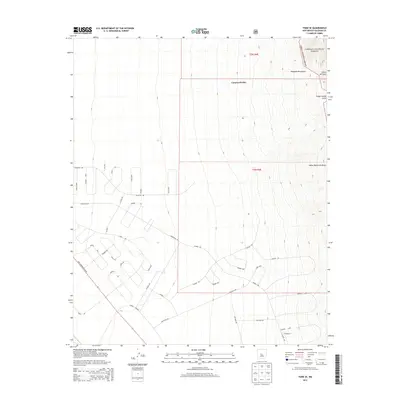
2013 Map of Tome SE
USGS Topo · Published 2013About this map
The Manzano Mountains dominate the eastern edge of this Valencia County landscape, where the high desert meets the protected reaches of the Cibola National Forest. This 2013 survey illustrates the intersection of steep, canyoned topography and modern residential expansion. While the northeast is defined by dramatic drainage features like Cañon del Sapo and Cañon Monte Largo, the western half reveals a sprawling network of planned residential streets. This development, including the Tierra Grande community, is structured around a grid of Spanish-named roads such as Diablo Dr and Estada. The map captures a transitional zone where the lower elevation drainage of Canyon del Rio gives way to the arterial connection of Rio Communities Blvd, highlighting the contrast between the uninhabited mountain forest and the deliberate layout of New Mexico’s modern rural-suburban frontier.
Find a feature on this map
41 named features on this map. Tap any name to fly to it.
Don’t see what you’re looking for? This feature index may not catch every label — zoom into the map to look around manually.
Map Details
Editions of this 2013 Tome SE Map
This is the sole edition of this map. No revisions or reprints were ever made.
Other maps of this area

1916 · La Joya
USGS Topo · 1:125,000

1917 · Estancia
USGS Topo · 1:125,000

1952 · Tome SE
USGS Topo · 1:24,000

1952 · Black Butte
USGS Topo · 1:24,000

1952 · Tome NE
USGS Topo · 1:24,000

1952 · Turn
USGS Topo · 1:24,000

1952 · Tome
USGS Topo · 1:24,000

1952 · Becker
USGS Topo · 1:24,000

1954 · Capilla Peak
USGS Topo · 1:24,000

1954 · Torreon
USGS Topo · 1:62,500