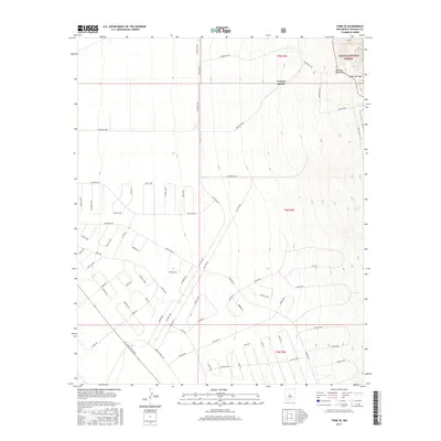
2017 Map of Tome SE
USGS Topo · Published 2017About this map
The eastern slopes of the Manzano Mountains dominate this 2017 topographic study of Valencia County, where the rugged terrain of the Cibola National Forest meets an expansive grid of planned residential development. A dense network of streets, characterized by loops and circles such as Lavar Loop, Canilla Loop, and Palta Cir, spreads across the high desert flats. This geometry of suburban planning contrasts sharply with the natural drainage patterns of Canyon del Rio and Canon del Sapo. Principal thoroughfares like Military Hwy and Commerce Blvd provide the primary north-south and east-west framework for the area. The map illustrates a moment of significant land platting and road construction, reflecting the contemporary growth patterns of the Rio Grande valley region as it reaches toward the mountain foothills.
Find a feature on this map
63 named features on this map. Tap any name to fly to it.
Don’t see what you’re looking for? This feature index may not catch every label — zoom into the map to look around manually.
Map Details
Editions of this 2017 Tome SE Map
This is the sole edition of this map. No revisions or reprints were ever made.
Other maps of this area

1916 · La Joya
USGS Topo · 1:125,000

1917 · Estancia
USGS Topo · 1:125,000

1952 · Tome SE
USGS Topo · 1:24,000

1952 · Black Butte
USGS Topo · 1:24,000

1952 · Tome NE
USGS Topo · 1:24,000

1952 · Turn
USGS Topo · 1:24,000

1952 · Tome
USGS Topo · 1:24,000

1952 · Becker
USGS Topo · 1:24,000

1954 · Capilla Peak
USGS Topo · 1:24,000

1954 · Torreon
USGS Topo · 1:62,500