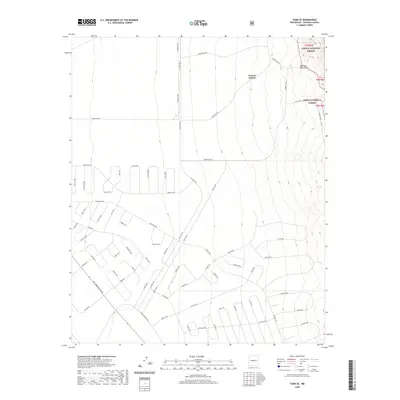
2020 Map of Tome SE
USGS Topo · Published 2020About this map
The western foothills of the Manzano Mountains dominate this 2020 landscape, where the high desert terrain of Valencia County meets a burgeoning network of modern road systems. A significant portion of the eastern quadrangle is protected within the Cibola National Forest, marked by the steep relief surrounding Canyon del Rio. To the west, the map documents a transition into a planned residential grid characterized by looping thoroughfares and long boulevards such as Commerce Blvd and Progress Blvd. The survey highlights a unique spatial organization where wide arterials like Military Hwy intersect with numerous circular residential developments, including Guadal Loop and Encargo Loop. This intricate web of roads illustrates the recent residential expansion and land division patterns south of Tome, contrasting sharply with the untouched wilderness of the national forest boundaries.
Find a feature on this map
62 named features on this map. Tap any name to fly to it.
Don’t see what you’re looking for? This feature index may not catch every label — zoom into the map to look around manually.
Map Details
Editions of this 2020 Tome SE Map
This is the sole edition of this map. No revisions or reprints were ever made.
Other maps of this area

1916 · La Joya
USGS Topo · 1:125,000

1917 · Estancia
USGS Topo · 1:125,000

1952 · Tome SE
USGS Topo · 1:24,000

1952 · Black Butte
USGS Topo · 1:24,000

1952 · Tome NE
USGS Topo · 1:24,000

1952 · Turn
USGS Topo · 1:24,000

1952 · Tome
USGS Topo · 1:24,000

1952 · Becker
USGS Topo · 1:24,000

1954 · Capilla Peak
USGS Topo · 1:24,000

1954 · Torreon
USGS Topo · 1:62,500