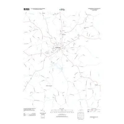
2013 Map of Tompkinsville
USGS Topo · Published 2013About this map
Tompkinsville serves as the focal point of this Monroe County landscape, situated at the junction of numerous rural routes that connect the surrounding agricultural communities. The terrain is defined by a dense network of waterways, including the Town Cr which winds past the town center and the E Fork Barren River flowing near Forkton. Significant for genealogical research, the map identifies several local burial grounds such as Oak Hill Cem and Brown Cem, alongside family-named landmarks like Moores Mill and Harlan Crossroads. The transition from the town’s residential streets to outlying settlements like Hestand and Grandview is documented through a detailed road system, including the namesake Brown Cemetery Rd and Oak Hill Cemetery Rd, providing a clear record of the area's development into the early 21st century.
Find a feature on this map
138 named features on this map. Tap any name to fly to it.
Don’t see what you’re looking for? This feature index may not catch every label — zoom into the map to look around manually.
Map Details
Editions of this 2013 Tompkinsville Map
This is the sole edition of this map. No revisions or reprints were ever made.
Other maps of this area

1929 · Tompkinsville
USGS Topo · 1:62,500

1931 · Red Boiling Springs
USGS Topo · 1:62,500

1953 · Sulphur Lick
USGS Topo · 1:24,000

1953 · Freedom
USGS Topo · 1:24,000

1953 · Dubre
USGS Topo · 1:24,000

1954 · Gamaliel
USGS Topo · 1:24,000

1954 · Tompkinsville
USGS Topo · 1:24,000
1954 · Vernon
USGS Topo · 1:24,000

1956 · Corbin
USGS Topo · 1:250,000

1958 · Corbin
USGS Topo · 1:250,000