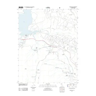
2012 Map of Toms Place
USGS Topo · Published 2012About this map
Lake Crowley and the high-elevation settlements of the eastern Sierra Nevada define this landscape during the early 2010s. The village of Toms Place serves as a central hub near the confluence of Rock Cr and Lower Rock Cr, surrounded by a dense network of mountain camps including French Camp Campground and Holiday Campground. The map reveals the intricate infrastructure required for mountain transit and water management, notably the Tunnel Number One along the Owens River corridor and the winding route of the Bishop Tuff Scenic Loop. From the recreational docks at South Landing to the meadows of Sky Meadow Ranch, the terrain transitions through geologic features like Little Round Valley and Whisky Canyon. This survey captures a moment when traditional camping sites and remote ranching outposts like Swall Meadow remained vital fixtures in this high-altitude environment.
Find a feature on this map
48 named features on this map. Tap any name to fly to it.
Don’t see what you’re looking for? This feature index may not catch every label — zoom into the map to look around manually.
Map Details
Editions of this 2012 Toms Place Map
This is the sole edition of this map. No revisions or reprints were ever made.
Other maps of this area

1912 · Mt. Goddard
USGS Topo · 1:125,000

1914 · Mt. Morrison
USGS Topo · 1:125,000

1947 · Mariposa
USGS Topo · 1:250,000

1948 · Mariposa
USGS Topo · 1:250,000

1949 · Mt. Tom
USGS Topo · 1:62,500

1951 · Mt. Tom
USGS Topo · 1:62,500

1953 · Mt. Morrison
USGS Topo · 1:62,500

1953 · Casa Diablo Mtn
USGS Topo · 1:62,500

1953 · Mt Abbot
USGS Topo · 1:62,500
1954 · Mt. Tom
USGS Topo · 1:62,500