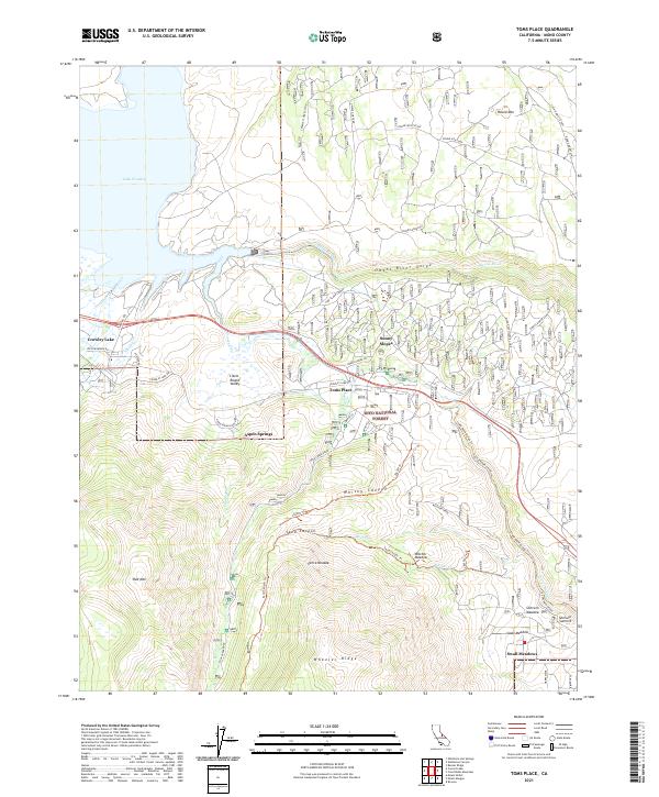
2021 Map of Toms Place
USGS Topo · Published 2021About this map
Toms Place and the surrounding high-altitude settlements of Crowley Lake and Sunny Slopes are depicted in this 2021 survey of the Eastern Sierra. The landscape is defined by the dramatic descent of the Owens River into the Owens River Gorge, a canyon complex that separates the Volcanic Tableland from the rising peaks of the Sierra Nevada. To the west, the expansive Lake Crowley serves as a central hydrological feature, fed by Hilton Cr, Whisky Cr, and Crooked Cr. The map details the local road and trail network that navigates these steep elevation changes, including the historic Old Sherwin Grade and the Lower Rock Creek Trail. Further south, the residential enclaves of Aspen Springs and Swall Meadows sit perched near Wheeler Ridge, while hikers and researchers can trace paths through Whisky Canyon, Sand Canyon, and across Sherwin Summit.
Find a feature on this map
55 named features on this map. Tap any name to fly to it.
Don’t see what you’re looking for? This feature index may not catch every label — zoom into the map to look around manually.
Map Details
Editions of this 2021 Toms Place Map
This is the sole edition of this map. No revisions or reprints were ever made.
Other maps of this area

1912 · Mt. Goddard
USGS Topo · 1:125,000

1914 · Mt. Morrison
USGS Topo · 1:125,000

1947 · Mariposa
USGS Topo · 1:250,000

1948 · Mariposa
USGS Topo · 1:250,000

1949 · Mt. Tom
USGS Topo · 1:62,500

1951 · Mt. Tom
USGS Topo · 1:62,500

1953 · Mt. Morrison
USGS Topo · 1:62,500

1953 · Casa Diablo Mtn
USGS Topo · 1:62,500

1953 · Mt Abbot
USGS Topo · 1:62,500
1954 · Mt. Tom
USGS Topo · 1:62,500