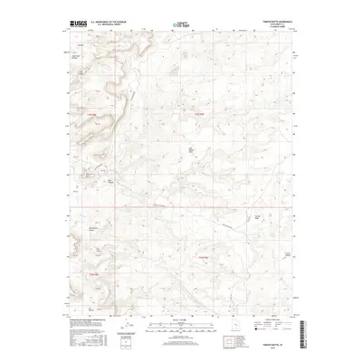
2017 Map of Tomsich Butte
USGS Topo · Published 2017About this map
San Rafael Swell defines the dramatic geological landscape of this Emery County region, where the erosive forces of Muddy Cr have carved deep into the desert floor. The map highlights the primitive Red Canyon Loop as it winds around the prominent Tomsich Butte and through the narrowing passage of The Chute. This area, characteristic of the remote backcountry of southeastern Utah, is marked by vital water sources in an otherwise arid environment, including Secret Springs and the Cistern Tanks. Significant terrain features like The Big Ridge and Penitentiary Canyon illustrate the complex drainage patterns and vertical relief that historically challenged travel through the canyonlands.
Find a feature on this map
29 named features on this map. Tap any name to fly to it.
Don’t see what you’re looking for? This feature index may not catch every label — zoom into the map to look around manually.
Map Details
Editions of this 2017 Tomsich Butte Map
This is the sole edition of this map. No revisions or reprints were ever made.
Other maps of this area

1885 · San Rafael
USGS Topo · 1:250,000

1885 · Fish Lake
USGS Topo · 1:250,000

1896 · Fish Lake
USGS Topo · 1:250,000

1952 · Wild Horse
USGS Topo · 1:62,500

1952 · San Rafael Knob
USGS Topo · 1:62,500

1953 · Stinking Spring Creek 2 SE
USGS Topo · 1:24,000

1953 · Emery 4 NE
USGS Topo · 1:24,000

1953 · Emery 4 SE
USGS Topo · 1:24,000

1953 · Emery 1 SE
USGS Topo · 1:24,000

1954 · Stinking Spring Creek 3 NW
USGS Topo · 1:24,000