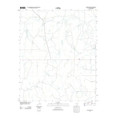
2013 Map of Tonk Creek
USGS Topo · Published 2013About this map
N Elm Cr and the waters of Tonk Cr define this landscape in Throckmorton County, where ranch roads and creek drainages create a distinct rural network. The northern reaches of the quadrangle are marked by the Elm Cr Reservoir, while the southern terrain is shaped by the Ranger Canyon Tank and the path of Ranger Cr. This territory is primarily characterized by its water management features and local drainage systems, with named points like Sellers Hill providing topographical variation.
Find a feature on this map
23 named features on this map. Tap any name to fly to it.
Don’t see what you’re looking for? This feature index may not catch every label — zoom into the map to look around manually.
Map Details
Editions of this 2013 Tonk Creek Map
This is the sole edition of this map. No revisions or reprints were ever made.
Other maps of this area

1954 · Wichita Falls
USGS Topo · 1:250,000

1958 · Wichita Falls
USGS Topo · 1:250,000

1962 · Antelope Creek SW
USGS Topo · 1:24,000

1962 · Antelope Creek SE
USGS Topo · 1:24,000

1965 · Reynolds Bend NW
USGS Topo · 1:24,000
1966 · Hoover Mountain
USGS Topo · 1:24,000

1966 · Westover SW
USGS Topo · 1:24,000
1966 · Reynolds Bend
USGS Topo · 1:24,000

1966 · Tonk Creek
USGS Topo · 1:24,000
1966 · Sibley Creek
USGS Topo · 1:24,000