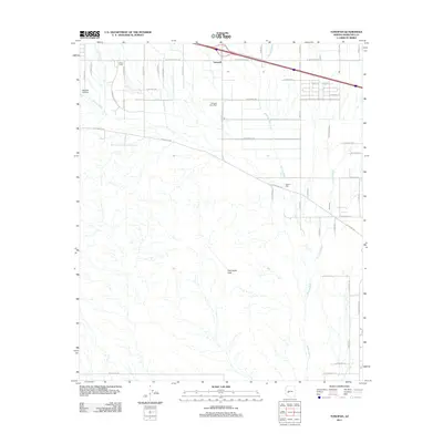
2011 Map of Tonopah
USGS Topo · Published 2011About this map
Tonopah serves as the central hub of this desert landscape in the western Maricopa County flatlands, centered around the Tonopah Post Office and a developing network of rural roads. The area's settlement pattern is defined by a rigid grid of avenues and drives, including N 439th Ave and W Indian School Rd, which contrast with the natural drainage paths of Winters Wash and Delaney Wash. To the west, the Lazy Y Ranch and Mauldin Airstrip indicate the remote residential and agricultural utility of the land during this period of growth. Southward, the terrain shifts toward the geological rising of the Palo Verde Hills, while localized landmarks like Winters Well highlight the critical historical importance of water access in this arid environment. This survey captures a moment of transition where traditional desert ranching meets expanding suburban infrastructure near the Interstate 10 corridor.
Find a feature on this map
47 named features on this map. Tap any name to fly to it.
Don’t see what you’re looking for? This feature index may not catch every label — zoom into the map to look around manually.
Map Details
Editions of this 2011 Tonopah Map
This is the sole edition of this map. No revisions or reprints were ever made.
Other maps of this area

1942 · Vicksburg
USGS Topo · 1:250,000

1954 · Phoenix
USGS Topo · 1:250,000

1957 · Phoenix
USGS Topo · 1:250,000

1958 · Phoenix
USGS Topo · 1:250,000

1960 · Phoenix
USGS Topo · 1:250,000

1961 · Big Horn Mts
USGS Topo · 1:62,500

1962 · Belmont Mts
USGS Topo · 1:62,500

1962 · Cortez Peak
USGS Topo · 1:62,500

1962 · Arlington
USGS Topo · 1:62,500

1969 · Phoenix
USGS Topo · 1:250,000