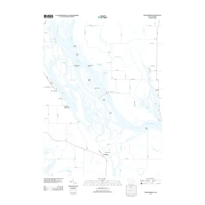
2013 Map of Toolesboro
USGS Topo · Published 2013About this map
The confluence of the Iowa River and the Mississippi River dominates this landscape, where a complex network of side channels and islands defines the border between Iowa and Illinois. The settlement of Toolesboro sits on the bluffs overlooking this river junction, providing a strategic view of the expansive Lake Odessa Public Hunting Area and the labyrinth of chutes and sloughs. This map reveals the intricate hydrologic character of the upper Mississippi, where features like Bogus Chute, Meyer Slough, and Ziegler Slough carve through the alluvial bottomlands.
Find a feature on this map
78 named features on this map. Tap any name to fly to it.
Don’t see what you’re looking for? This feature index may not catch every label — zoom into the map to look around manually.
Map Details
Editions of this 2013 Toolesboro Map
This is the sole edition of this map. No revisions or reprints were ever made.
Other maps of this area

1916 · Edgington
USGS Topo · 1:62,500

1935 · Keithsburg
USGS Topo · 1:48,000

1938 · Edgington
USGS Topo · 1:62,500

1941 · Keithsburg
USGS Topo · 1:62,500

1946 · Wapello
USGS Topo · 1:62,500

1948 · Muscatine
USGS Topo · 1:62,500

1949 · Wapello
USGS Topo · 1:62,500

1953 · Toolesboro
USGS Topo · 1:24,000

1953 · Blanchard Island
USGS Topo · 1:24,000
1953 · Eliza
USGS Topo · 1:24,000