
1953 Map of Toolesboro
USGS Topo · Published 1958About this map
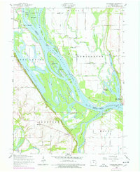
The Mississippi River creates a dynamic boundary between Iowa and Illinois in the early 1950s, defining a landscape of complex waterways and island systems. Central to this map is the transition between the river and the expansive Lake Odessa, punctuated by features like Turkey Island and Otter Island. The presence of the New Boston Ferry and the Dismantled railroad indicates a period of shifting transportation modes as old river and rail dependencies evolved.
Find a feature on this map
56 named features on this map. Tap any name to fly to it.
Don’t see what you’re looking for? This feature index may not catch every label — zoom into the map to look around manually.
Map Details
Editions of this 1953 Toolesboro Map
2 editions found
Other maps of this area

1916 · Edgington
USGS Topo · 1:62,500

1935 · Keithsburg
USGS Topo · 1:48,000

1938 · Edgington
USGS Topo · 1:62,500

1941 · Keithsburg
USGS Topo · 1:62,500

1946 · Wapello
USGS Topo · 1:62,500

1948 · Muscatine
USGS Topo · 1:62,500

1949 · Wapello
USGS Topo · 1:62,500

1953 · Blanchard Island
USGS Topo · 1:24,000
1953 · Eliza
USGS Topo · 1:24,000
1953 · Joy
USGS Topo · 1:24,000