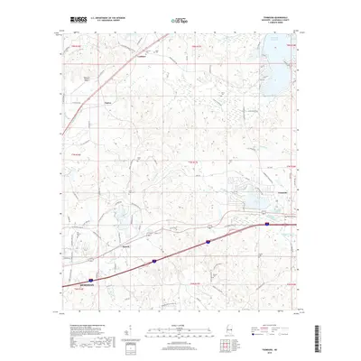
2018 Map of Toomsuba
USGS Topo · Published 2018About this map
The settlement of Toomsuba and the eastern edge of Meridian define this Lauderdale County landscape, where the headwaters of Toomsuba Creek and Sucatobba Cr weave through a network of rural roads and small communities. This 2018 survey reveals a territory marked by family-named cemeteries and modern infrastructure, from the Lockhart community in the north to Russell near the western boundary. The presence of Topton Air Estates Airport near Topton highlights the region's specialized development alongside established landmarks like Bailey Lake. Genealogy researchers will find significant value in the distribution of burial sites across the township lines, including Old Marion Cem, Pigford Cem, and Rawson Cem. The road network, including Lauderdale Toomsuba Rd and Cotton Gin Rd, connects these disparate points of local history across a landscape shaped by drainage basins like Nanabe Cr and Buckatunna Cr.
Find a feature on this map
95 named features on this map. Tap any name to fly to it.
Don’t see what you’re looking for? This feature index may not catch every label — zoom into the map to look around manually.
Map Details
Editions of this 2018 Toomsuba Map
This is the sole edition of this map. No revisions or reprints were ever made.
Other maps of this area

1921 · Meridian
USGS Topo · 1:48,000

1923 · Meridian
USGS Topo · 1:62,500

1953 · Meridian
USGS Topo · 1:250,000

1957 · Meridian
USGS Topo · 1:250,000

1962 · Daleville
USGS Topo · 1:24,000

1962 · Lauderdale
USGS Topo · 1:24,000

1965 · Meridian
USGS Topo · 1:250,000

1971 · Vimville
USGS Topo · 1:24,000

1971 · Meridian South
USGS Topo · 1:24,000

1971 · Meridian North
USGS Topo · 1:24,000