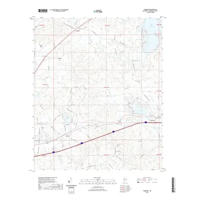
2020 Map of Toomsuba
USGS Topo · Published 2020About this map
Toomsuba and Lockhart anchor this portion of Lauderdale County, where the landscape is defined by the drainage networks of Toomsuba Creek and Sucatobba Cr. The area reflects a transition from traditional rural settlements to residential developments around water features, notably Dalewood Shore Lake and Bailey Lake. For genealogists, the map is particularly rich in family-named landmarks and local burial grounds, including the Good Hope Cem, Pigford Cem, and Old Marion Cem near Russell. Transportation infrastructure is central to the local geography, with Interstate 20 cutting through the terrain and the Topton Air Estates Airport situated near Topton. The intricate network of local roads like Lick Skillet Rd and Minnow Bucket Rd provides a detailed view of the modern rural road system and small-scale land divisions.
Find a feature on this map
89 named features on this map. Tap any name to fly to it.
Don’t see what you’re looking for? This feature index may not catch every label — zoom into the map to look around manually.
Map Details
Editions of this 2020 Toomsuba Map
This is the sole edition of this map. No revisions or reprints were ever made.
Other maps of this area

1921 · Meridian
USGS Topo · 1:48,000

1923 · Meridian
USGS Topo · 1:62,500

1953 · Meridian
USGS Topo · 1:250,000

1957 · Meridian
USGS Topo · 1:250,000

1962 · Daleville
USGS Topo · 1:24,000

1962 · Lauderdale
USGS Topo · 1:24,000

1965 · Meridian
USGS Topo · 1:250,000

1971 · Vimville
USGS Topo · 1:24,000

1971 · Meridian South
USGS Topo · 1:24,000

1971 · Meridian North
USGS Topo · 1:24,000