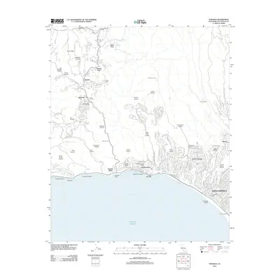
2012 Map of Topanga
USGS Topo · Published 2012About this map
Santa Monica and the coastal neighborhoods of Pacific Palisades are shown in high detail where the Santa Monica Mountains meet the Pacific Ocean. This 2012 survey captures a landscape of steep canyons and ridges, where residential development such as Topanga Oaks and Castellammare is woven into the complex terrain of Topanga Canyon and Temescal Canyon. Large estate-scale properties and historic landmarks are prominent, including Will Rogers Ranch and Trippet Ranch, alongside the sprawling Presbyterian Conference Grounds.
Find a feature on this map
68 named features on this map. Tap any name to fly to it.
Don’t see what you’re looking for? This feature index may not catch every label — zoom into the map to look around manually.
Map Details
Editions of this 2012 Topanga Map
This is the sole edition of this map. No revisions or reprints were ever made.
Other maps of this area

1894 · Los Angeles
USGS Topo · 1:62,500

1896 · Redondo
USGS Topo · 1:62,500

1896 · Santa Monica
USGS Topo · 1:62,500

1898 · Santa Monica
USGS Topo · 1:62,500

1900 · Los Angeles
USGS Topo · 1:62,500

1901 · Southern California Sheet No. 1
USGS Topo · 1:250,000

1902 · Santa Monica
USGS Topo · 1:62,500

1903 · Calabasas
USGS Topo · 1:62,500

1903 · Camulos
USGS Topo · 1:125,000

1904 · Southern California Sheet No. 1
USGS Topo · 1:250,000
Featured Places
- Los Angeles, CA
- Santa Monica, CA
- Malibu, CA
- Unincorporated Santa Monica Mountains, CA
- Sylvia Park, Topanga