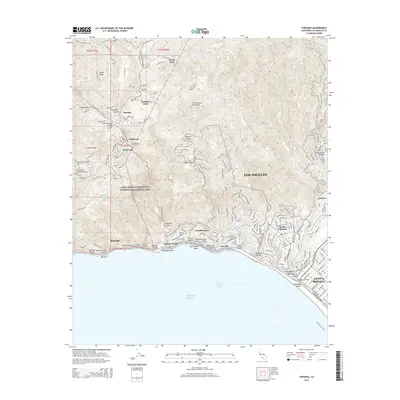
2015 Map of Topanga
USGS Topo · Published 2015About this map
The Santa Monica Mountains define the high relief of this coastal landscape, where the canyons of Topanga Canyon and Temescal Canyon carve paths toward the Pacific Ocean. Early 21st-century residential clusters are concentrated in the interior heights at Topanga Oaks, Fernwood, and Wildwood, while dense suburban development of Pacific Palisades and the Riviera neighborhood occupies the coastal bluffs to the southeast. Historically significant sites along the Santa Monica Bay shoreline include the old film-era location of Inceville and the terraced streets of Castellammare. The map details an intricate network of mountain roads such as Fernwood Pacific Dr and Tuna Canyon Rd, which navigate the steep terrain between Henry Ridge and the beach landings at Las Tunas Beach. Much of the central portion is preserved within the Santa Monica Mountains National Recreation Area.
Find a feature on this map
187 named features on this map. Tap any name to fly to it.
Don’t see what you’re looking for? This feature index may not catch every label — zoom into the map to look around manually.
Map Details
Editions of this 2015 Topanga Map
This is the sole edition of this map. No revisions or reprints were ever made.
Other maps of this area

1894 · Los Angeles
USGS Topo · 1:62,500

1896 · Redondo
USGS Topo · 1:62,500

1896 · Santa Monica
USGS Topo · 1:62,500

1898 · Santa Monica
USGS Topo · 1:62,500

1900 · Los Angeles
USGS Topo · 1:62,500

1901 · Southern California Sheet No. 1
USGS Topo · 1:250,000

1902 · Santa Monica
USGS Topo · 1:62,500

1903 · Calabasas
USGS Topo · 1:62,500

1903 · Camulos
USGS Topo · 1:125,000

1904 · Southern California Sheet No. 1
USGS Topo · 1:250,000
Featured Places
- Los Angeles, CA
- Santa Monica, CA
- Malibu, CA
- Unincorporated Santa Monica Mountains, CA
- Sylvia Park, Topanga