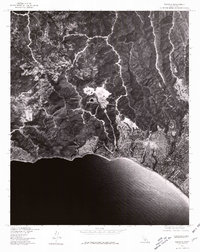
1976 Map of Topanga
USGS Topo · Published 1981About this map
Pacific Palisades and the surrounding Santa Monica Mountains are captured in this 1976 orthophotograph, providing a literal aerial perspective of coastal development and steep canyon terrain. The imagery highlights the dense residential patterns extending toward the bluffs above the Pacific Ocean, contrasting sharply with the undeveloped slopes of the interior. Further inland, the settlements of Fernwood and Topanga are visible as they follow the winding contours of the canyons, illustrating how local geography dictated the growth of these communities. Produced in cooperation with the Soil Conservation Service, the map reveals the complex intersection of geological formations and human habitation during a period of significant suburban expansion along the Southern California coast.
Find a feature on this map
3 named features on this map. Tap any name to fly to it.
Don’t see what you’re looking for? This feature index may not catch every label — zoom into the map to look around manually.
Map Details
Editions of this 1976 Topanga Map
This is the sole edition of this map. No revisions or reprints were ever made.
Other maps of this area

1894 · Los Angeles
USGS Topo · 1:62,500

1896 · Redondo
USGS Topo · 1:62,500

1896 · Santa Monica
USGS Topo · 1:62,500

1898 · Santa Monica
USGS Topo · 1:62,500

1900 · Los Angeles
USGS Topo · 1:62,500

1901 · Southern California Sheet No. 1
USGS Topo · 1:250,000

1902 · Santa Monica
USGS Topo · 1:62,500

1903 · Calabasas
USGS Topo · 1:62,500

1903 · Camulos
USGS Topo · 1:125,000

1904 · Southern California Sheet No. 1
USGS Topo · 1:250,000