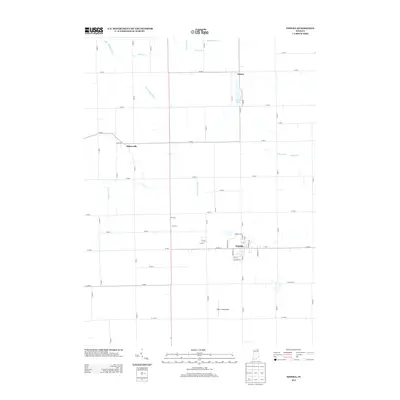
2013 Map of Topeka
USGS Topo · Published 2013About this map
Topeka serves as the primary hub in this portion of LaGrange County, characterized by its traditional grid of streets like Lehman Ave and Hawpatch Dr. The surrounding landscape is defined by an extensive network of managed waterways, including the Little Elkhart River, Rowe-Eden Ditch, and Hostetler Ditch, which support the agricultural productivity of the region. This 2013 survey illustrates a rural environment where small settlements like Emma and Honeyville remain distinct, connected by a rigid system of county roads such as S 1000 W and W 200 S. The area around Emma Lake and the Miller Field Airport to the south provides a view into the mix of recreational and small-scale aviation infrastructure that services these tight-knit Indiana communities.
Find a feature on this map
60 named features on this map. Tap any name to fly to it.
Don’t see what you’re looking for? This feature index may not catch every label — zoom into the map to look around manually.
Map Details
Editions of this 2013 Topeka Map
This is the sole edition of this map. No revisions or reprints were ever made.
Other maps of this area

1947 · Lagrange
USGS Topo · 1:24,000

1947 · Oliver Lake
USGS Topo · 1:24,000

1951 · Wawasee
USGS Topo · 1:24,000

1953 · Fort Wayne
USGS Topo · 1:250,000

1956 · Fort Wayne
USGS Topo · 1:250,000

1956 · Ligonier
USGS Topo · 1:24,000

1956 · Albion
USGS Topo · 1:24,000

1959 · Topeka
USGS Topo · 1:24,000
1959 · Oliver Lake
USGS Topo · 1:24,000

1959 · Millersburg
USGS Topo · 1:24,000