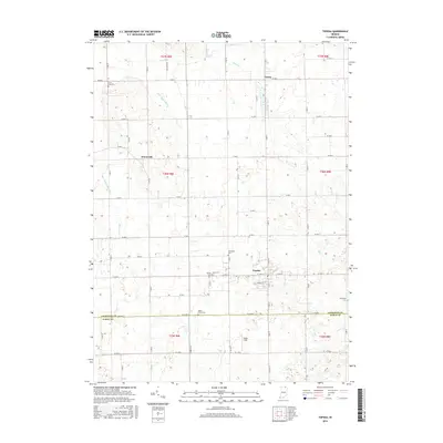
2016 Map of Topeka
USGS Topo · Published 2016About this map
Topeka sits at the heart of this agricultural landscape in southern LaGrange County, where the regular grid of county roads meets a landscape defined by glacial drainage. The Little Elkhart River and numerous managed waterways like Hostetler Ditch and Farver Ditch indicate a history of land reclamation for farming. Small unincorporated settlements like Honeyville and Emma are clustered around local intersections, while the map reveals a dense concentration of local burial grounds. Genealogists will find interest in the proximity of Eden Cem, Gerber Cem, and Hawpatch Cem, which speak to the area's deep-rooted family histories and religious communities. Along the southern border, the line between LaGrange Co Noble Co marks the transition into the neighboring county, while landmarks like Miller Field provide specific points of local reference.
Find a feature on this map
39 named features on this map. Tap any name to fly to it.
Don’t see what you’re looking for? This feature index may not catch every label — zoom into the map to look around manually.
Map Details
Editions of this 2016 Topeka Map
This is the sole edition of this map. No revisions or reprints were ever made.
Other maps of this area

1947 · Lagrange
USGS Topo · 1:24,000

1947 · Oliver Lake
USGS Topo · 1:24,000

1951 · Wawasee
USGS Topo · 1:24,000

1953 · Fort Wayne
USGS Topo · 1:250,000

1956 · Fort Wayne
USGS Topo · 1:250,000

1956 · Ligonier
USGS Topo · 1:24,000

1956 · Albion
USGS Topo · 1:24,000

1959 · Topeka
USGS Topo · 1:24,000
1959 · Oliver Lake
USGS Topo · 1:24,000

1959 · Millersburg
USGS Topo · 1:24,000