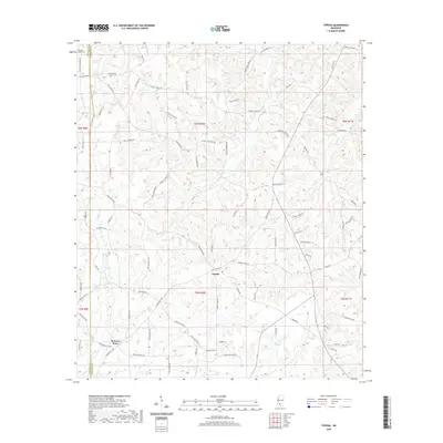
2020 Map of Topeka
USGS Topo · Published 2020About this map
Topeka serves as a central junction within this Lawrence County landscape, where the rural character of south-central Mississippi is defined by a dense network of creeks and timbered ridges. The settlement at Bristers Store anchors the western edge of the quadrangle near the boundary between Lincoln and Lawrence counties. For genealogists and local historians, the Pleasant Grove Cem provides a specific point of interest in the northwestern corner, tucked among family-named routes such as Ben Mason Rd and Frog Ridge Rd. The drainage patterns of Topisaw Cr and Halls Cr dictate the winding paths of local roads, reflecting a landscape where transport follows the natural contours of the stream valleys rather than a rigid grid.
Find a feature on this map
86 named features on this map. Tap any name to fly to it.
Don’t see what you’re looking for? This feature index may not catch every label — zoom into the map to look around manually.
Map Details
Editions of this 2020 Topeka Map
This is the sole edition of this map. No revisions or reprints were ever made.
Other maps of this area

1953 · Natchez
USGS Topo · 1:250,000

1956 · Natchez
USGS Topo · 1:250,000

1959 · Natchez
USGS Topo · 1:250,000

1970 · Topeka
USGS Topo · 1:24,000

1970 · Monticello
USGS Topo · 1:24,000

1970 · Darbun
USGS Topo · 1:24,000

1970 · Jayess
USGS Topo · 1:24,000

1970 · Nola
USGS Topo · 1:24,000
1970 · Tilton
USGS Topo · 1:24,000

1972 · Fair Oak Springs
USGS Topo · 1:24,000