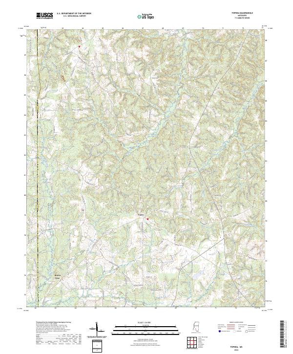
2024 Map of Topeka
USGS Topo · Published 2024About this map
Topeka and Bristers Store anchor this contemporary survey of the rural landscape where the border of Lincoln and Lawrence counties meets. The terrain is defined by a dense network of minor waterways including Coopers Creek, East Topeka Creek, and Tilton Creek, which carve through the wooded hillsides. The mapping of countless local thoroughfares like Carmel New Hope Rd, Lee Hedgepeth Rd, and Thames Nelson Rd reflects the enduring pattern of family landholdings and small-scale agriculture that has shaped this part of Mississippi for generations. By documenting the intersection of Lincoln Co Lawrence Co, the map highlights how the local road network persists even as larger regional developments shift elsewhere, preserving the locations of historic rural hubs that have served the surrounding homesteads since the early twentieth century.
Find a feature on this map
89 named features on this map. Tap any name to fly to it.
Don’t see what you’re looking for? This feature index may not catch every label — zoom into the map to look around manually.
Map Details
Editions of this 2024 Topeka Map
This is the sole edition of this map. No revisions or reprints were ever made.
Other maps of this area

1953 · Natchez
USGS Topo · 1:250,000

1956 · Natchez
USGS Topo · 1:250,000

1959 · Natchez
USGS Topo · 1:250,000

1970 · Topeka
USGS Topo · 1:24,000

1970 · Monticello
USGS Topo · 1:24,000

1970 · Darbun
USGS Topo · 1:24,000

1970 · Jayess
USGS Topo · 1:24,000

1970 · Nola
USGS Topo · 1:24,000
1970 · Tilton
USGS Topo · 1:24,000

1972 · Fair Oak Springs
USGS Topo · 1:24,000