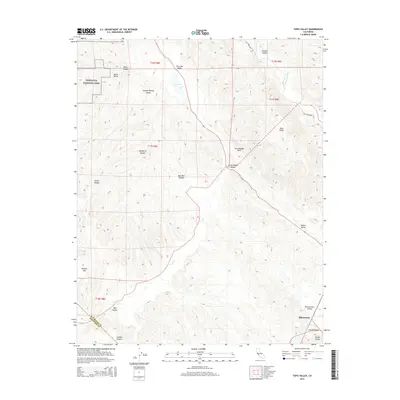
2015 Map of Topo Valley
USGS Topo · Published 2015About this map
The San Andreas Fault cuts a diagonal path through this 2015 study of the California Coast Ranges, dividing the complex terrain of the Diablo Range from the valley floor. To the northwest, the edge of Pinnacles National Park borders a landscape of steep drainages like Rosas Canyon and Wildhorse Canyon. The central and eastern portions are dominated by a series of high-altitude basins and valleys, including Horse Valley, Dry Lake Valley, and the elongated Rabbit Valley. In the southeastern corner, the settlement of Bitterwater sits within the Bitterwater Valley along King City Rd, marking a rare point of concentration in a region otherwise defined by ranching land and seasonal water features such as Dry Lake and the San Benito River. This map illustrates the intersection of tectonic geology and the long-established land divisions of the Public Land Survey System.
Find a feature on this map
29 named features on this map. Tap any name to fly to it.
Don’t see what you’re looking for? This feature index may not catch every label — zoom into the map to look around manually.
Map Details
Editions of this 2015 Topo Valley Map
This is the sole edition of this map. No revisions or reprints were ever made.
Other maps of this area

1912 · Metz
USGS Topo · 1:31,680

1913 · Panoche
USGS Topo · 1:125,000

1915 · Priest Valley
USGS Topo · 1:125,000

1919 · San Benito
USGS Topo · 1:62,500

1921 · Metz
USGS Topo · 1:62,500

1931 · San Benito
USGS Topo · 1:62,500

1940 · Metz
USGS Topo · 1:62,500

1940 · San Benito
USGS Topo · 1:62,500

1943 · Hernandez Valley
USGS Topo · 1:62,500

1944 · Hernandez Valley
USGS Topo · 1:62,500