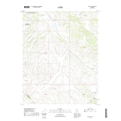
2018 Map of Topo Valley
USGS Topo · Published 2018About this map
The Gabilan Range dominates this portion of the Central Coast, where high ridges and deep canyons define the landscape of southeastern San Benito County. The small settlement of Bitterwater sits at the junction of CO Hwy G13 and Topo Valley Rd, serving as a focal point for the surrounding Bitterwater Valley. The topography is marked by a complex system of seasonal drainages and named valleys, including Little Rabbit Valley and Dry Lake Valley, the latter containing a prominent Dry Lake.
Find a feature on this map
32 named features on this map. Tap any name to fly to it.
Don’t see what you’re looking for? This feature index may not catch every label — zoom into the map to look around manually.
Map Details
Editions of this 2018 Topo Valley Map
This is the sole edition of this map. No revisions or reprints were ever made.
Other maps of this area

1912 · Metz
USGS Topo · 1:31,680

1913 · Panoche
USGS Topo · 1:125,000

1915 · Priest Valley
USGS Topo · 1:125,000

1919 · San Benito
USGS Topo · 1:62,500

1921 · Metz
USGS Topo · 1:62,500

1931 · San Benito
USGS Topo · 1:62,500

1940 · Metz
USGS Topo · 1:62,500

1940 · San Benito
USGS Topo · 1:62,500

1943 · Hernandez Valley
USGS Topo · 1:62,500

1944 · Hernandez Valley
USGS Topo · 1:62,500