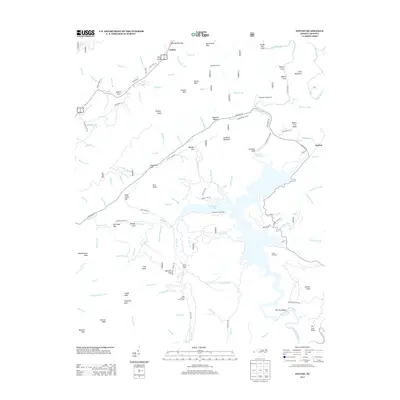
2013 Map of Topton
USGS Topo · Published 2013About this map
Nantahala Lake and its intricate shoreline dominate this 2013 survey of the North Carolina mountains, where the Nantahala River and the Valley River carve through high elevation peaks. The topography is defined by significant gaps and balds, such as Red Marble Gap and Tusquitee Bald, which have historically dictated the passage of roads and water. The settlement at Topton sits at a critical junction near Trim Cove, while the eastern side of the lake shows the community of Aquone and the winding Nantahala Dam Drive. The presence of the Nantahala Tunnel and recreational hubs like Appletree Campground and the Bob Allison Picnic Area reflect a landscape managed for both utility and conservation. Family-named features such as Kimsey Cove, Lambert Mountain, and Piercy Bald indicate a long history of local land use and residency in these coves.
Find a feature on this map
127 named features on this map. Tap any name to fly to it.
Don’t see what you’re looking for? This feature index may not catch every label — zoom into the map to look around manually.
Map Details
Editions of this 2013 Topton Map
This is the sole edition of this map. No revisions or reprints were ever made.
Other maps of this area

1933 · Bushnell
USGS Topo · 1:62,500

1935 · Rainbow Springs
USGS Topo · 1:24,000

1935 · Robbinsville
USGS Topo · 1:24,000

1935 · Shooting Creek
USGS Topo · 1:24,000

1935 · Burningtown Bald
USGS Topo · 1:24,000

1935 · Topton
USGS Topo · 1:24,000

1935 · Wayah Bald
USGS Topo · 1:48,000

1935 · Andrews
USGS Topo · 1:24,000
1935 · Hayesville
USGS Topo · 1:24,000

1936 · Wesser
USGS Topo · 1:24,000