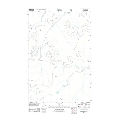
2011 Map of Torino Peak
USGS Topo · Published 2011About this map
Torino Peak and the high ridges of the Bitterroot Mountains dominate this landscape along the Idaho-Montana border. In the early 21st century, this remote terrain remained characterized by its deep gulches and significant water sources, including the headwaters of the South Fork Little Joe Creek and the North Fork Little Joe Creek. The drainage patterns here are complex, with waters flowing from high points like Sunset Peak and Little Joe Mountain into named valleys such as Ann Arbor Gulch and Fourth of July Gulch.
Find a feature on this map
60 named features on this map. Tap any name to fly to it.
Don’t see what you’re looking for? This feature index may not catch every label — zoom into the map to look around manually.
Map Details
Editions of this 2011 Torino Peak Map
This is the sole edition of this map. No revisions or reprints were ever made.
Other maps of this area

1918 · St Regis
USGS Topo · 1:125,000

1919 · St. Regis
USGS Topo · 1:125,000

1956 · St Regis
USGS Topo · 1:62,500

1956 · Wallace
USGS Topo · 1:250,000

1957 · Illinois Peak
USGS Topo · 1:62,500

1957 · Haugan
USGS Topo · 1:62,500

1957 · Simmons Peak
USGS Topo · 1:62,500

1960 · Wallace
USGS Topo · 1:250,000
1988 · St Regis
USGS Topo · 1:24,000
1988 · Sherlock Peak
USGS Topo · 1:24,000