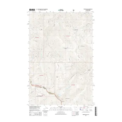
2014 Map of Torino Peak
USGS Topo · Published 2014About this map
Torino Peak and the high ridges of the Bitterroot Range define this high-altitude landscape along the border of Idaho and Montana. The terrain is a complex network of deep drainages such as Ann Arbor Gulch and Hendrickson Gulch, which feed into various forks of Little Joe Cr. The map reveals a wilderness managed by the Lolo National Forest and St Joe National Forest, where few roads penetrate the steep topography.
Find a feature on this map
35 named features on this map. Tap any name to fly to it.
Don’t see what you’re looking for? This feature index may not catch every label — zoom into the map to look around manually.
Map Details
Editions of this 2014 Torino Peak Map
This is the sole edition of this map. No revisions or reprints were ever made.
Other maps of this area

1918 · St Regis
USGS Topo · 1:125,000

1919 · St. Regis
USGS Topo · 1:125,000

1956 · St Regis
USGS Topo · 1:62,500

1956 · Wallace
USGS Topo · 1:250,000

1957 · Illinois Peak
USGS Topo · 1:62,500

1957 · Haugan
USGS Topo · 1:62,500

1957 · Simmons Peak
USGS Topo · 1:62,500

1960 · Wallace
USGS Topo · 1:250,000
1988 · St Regis
USGS Topo · 1:24,000
1988 · Sherlock Peak
USGS Topo · 1:24,000