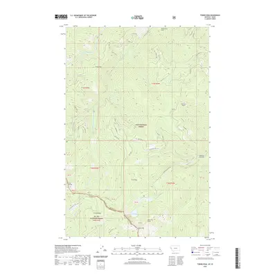
2020 Map of Torino Peak
USGS Topo · Published 2020About this map
The Bitterroot Range forms the backbone of this topographic study, defining the high-altitude boundary between Idaho and Montana. This high ridgeline, labeled simply as the State Line, separates Shoshone County and Mineral Co, creating a sharp divide between the St. Joe National Forest to the southwest and the Lolo National Forest to the northeast. Elevation peaks at landmarks like Torino Peak and Sunset Peak, while the drainage basins of the N Fork Little Joe Creek and Torino Creek carve deep gulches into the mountain faces.
Find a feature on this map
37 named features on this map. Tap any name to fly to it.
Don’t see what you’re looking for? This feature index may not catch every label — zoom into the map to look around manually.
Map Details
Editions of this 2020 Torino Peak Map
This is the sole edition of this map. No revisions or reprints were ever made.
Other maps of this area

1918 · St Regis
USGS Topo · 1:125,000

1919 · St. Regis
USGS Topo · 1:125,000

1956 · St Regis
USGS Topo · 1:62,500

1956 · Wallace
USGS Topo · 1:250,000

1957 · Illinois Peak
USGS Topo · 1:62,500

1957 · Haugan
USGS Topo · 1:62,500

1957 · Simmons Peak
USGS Topo · 1:62,500

1960 · Wallace
USGS Topo · 1:250,000
1988 · St Regis
USGS Topo · 1:24,000
1988 · Sherlock Peak
USGS Topo · 1:24,000